


Noah Larsen and Arthur Shain returned from their Alaska Packrafting Expedition full of appreciation of the area, their steadfast gear and their personal growth. Here’s an account of their trip:
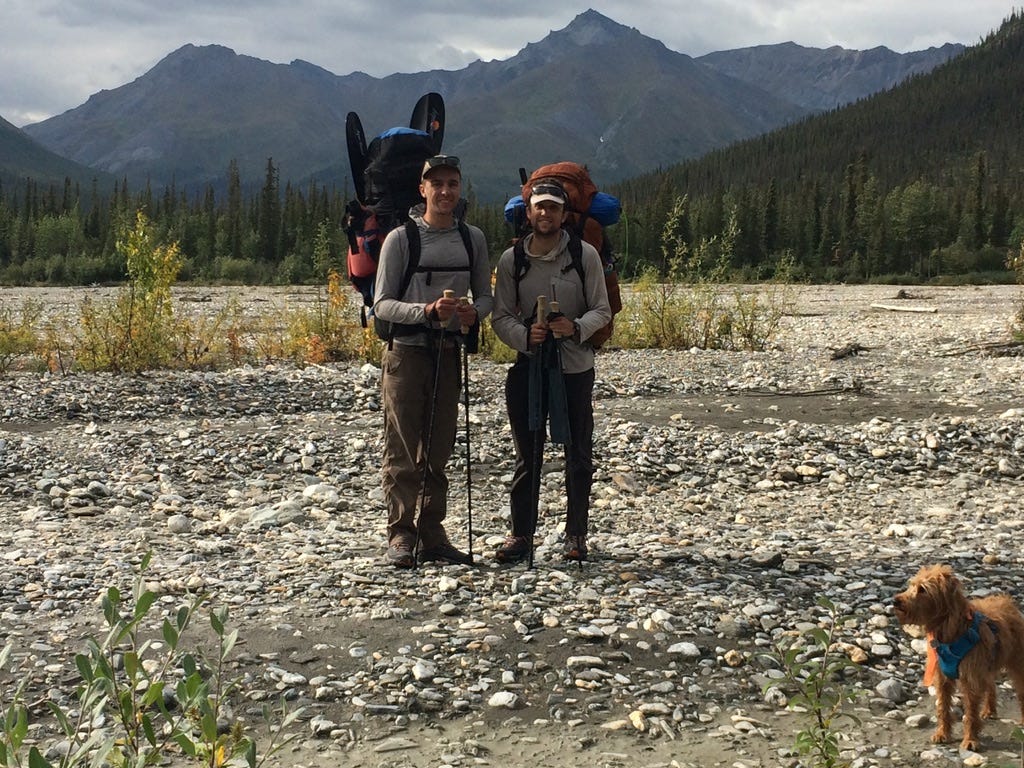
Our westerly traverse of the Brooks Range and Gates of the Arctic National Park began about 20 miles south of Atigun Pass and the continental divide. It was a beautiful blue sky day. From the car, we crossed the Dietrich River and, together with our friend Jim and his terrier Daisy, started walking up Trembley Creek. Almost immediately we started seeing wolf prints and bear scat. The drainage eventually narrowed into a small canyon that we had to exit via a scree slope. Daisy was happy to be out of the water. At camp that night, we saw a grizzly bear walking across the opposite hillside. It did not notice us until the following morning, when it jogged down the hillside to investigate us. We took this as our sign to start hiking; we said a quick goodbye to Jim and continued up the creek.
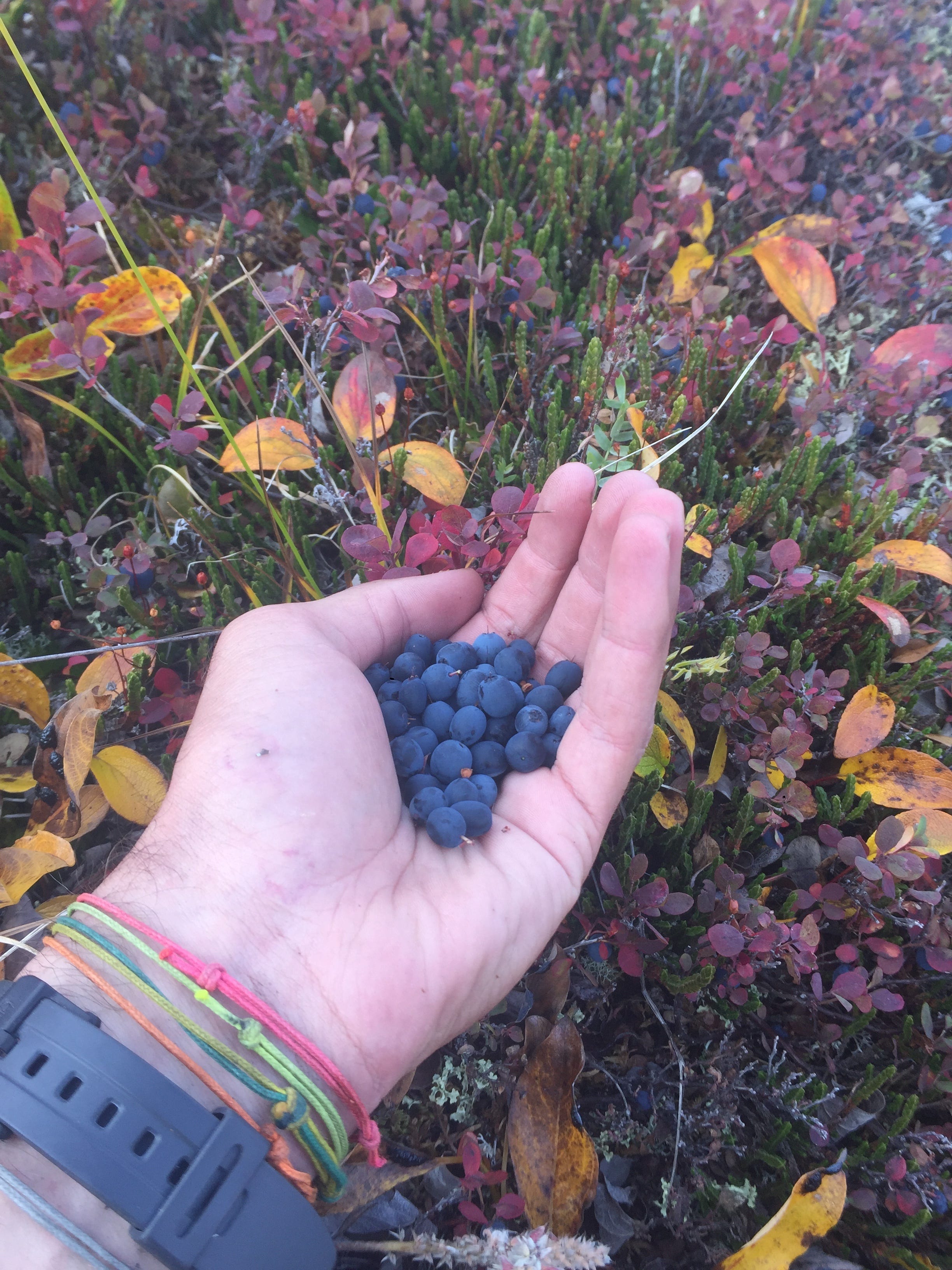
That night we set up our shelter at Kinnorutin Pass. It was an expansive and vaguely formed pass with tall peaks and no trees in sight. Having carried three weeks worth of food, we were tired by the end of the day. Nevertheless, we found some time to snack on wild blueberries growing at our camp.

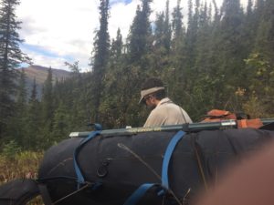
The next day we descended Amawk Creek by foot and arrived at the North Fork of the Koyukuk River, where there was enough water for us to inflate our packrafts. The river was bony, fast-moving, and clear enough to see the polished rocks on the river bed below. We encountered some shallow sections and downed trees, where we had to carry our boats around, and deeper sections with class 3 rapids. We packed up our packrafts at the river’s intersection with Ernie Creek. We traveled along the creek, where we found the hiking challenging and seemingly characteristic of this region of Alaska; the ground was wet and spongy, covered in tussocks.

We woke up at our camp on a sand bar and prepared for another eleven-hour day of travel. We were aiming to reach Ernie Pass, located at 3402 feet. We primarily hiked on the flat gravel bars, crossing the river repeatedly. Ernie Pass covered a large flat area and the terrain north of it formed a long valley between two rows of shale peaks. There, we met a man from the indigenous village of Anaktuvuk Pass, who was riding an ATV and in search of a caribou. His wife had asked him to bring one home for dinner. He was one of only two parties we would see during the entire trip. That night, we camped alongside the Anaktuvuk River.
We hiked downstream along the river until it was deep enough to float. We passed a caribou carcass. As we moved downstream, we passed a few patches of snow. The river often separated into many channels, and we barely floated through some of the shallow water, passing over gravel bars and through twisting tunnels of trees. Looking back on our itinerary, we appreciated how the packrafting sections gave our legs a chance to recover.
Our camp along the river set us about four miles from the native village of Anaktuvuk Pass. We had initially planned to fly to the village to start our trip, but we have since decided that the section from the Dalton Highway to the village was not to be missed and perhaps our favorite one. Ultimately, we did not start at Anaktuvuk Pass because, due to the pandemic, the mayor asked us not to come. So, from the river, we ascended up to 2500 feet and contoured above and around the village, always keeping at least 1.5 miles from the town. We saw numerous caribou racks which had been bleached by the sun. Once we were south of town, we inflated our boats and paddled down the bottom of Inukpasugruk Creek, which quickly spat us into the John River.
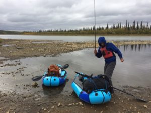
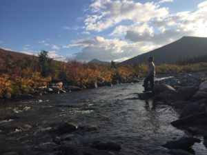
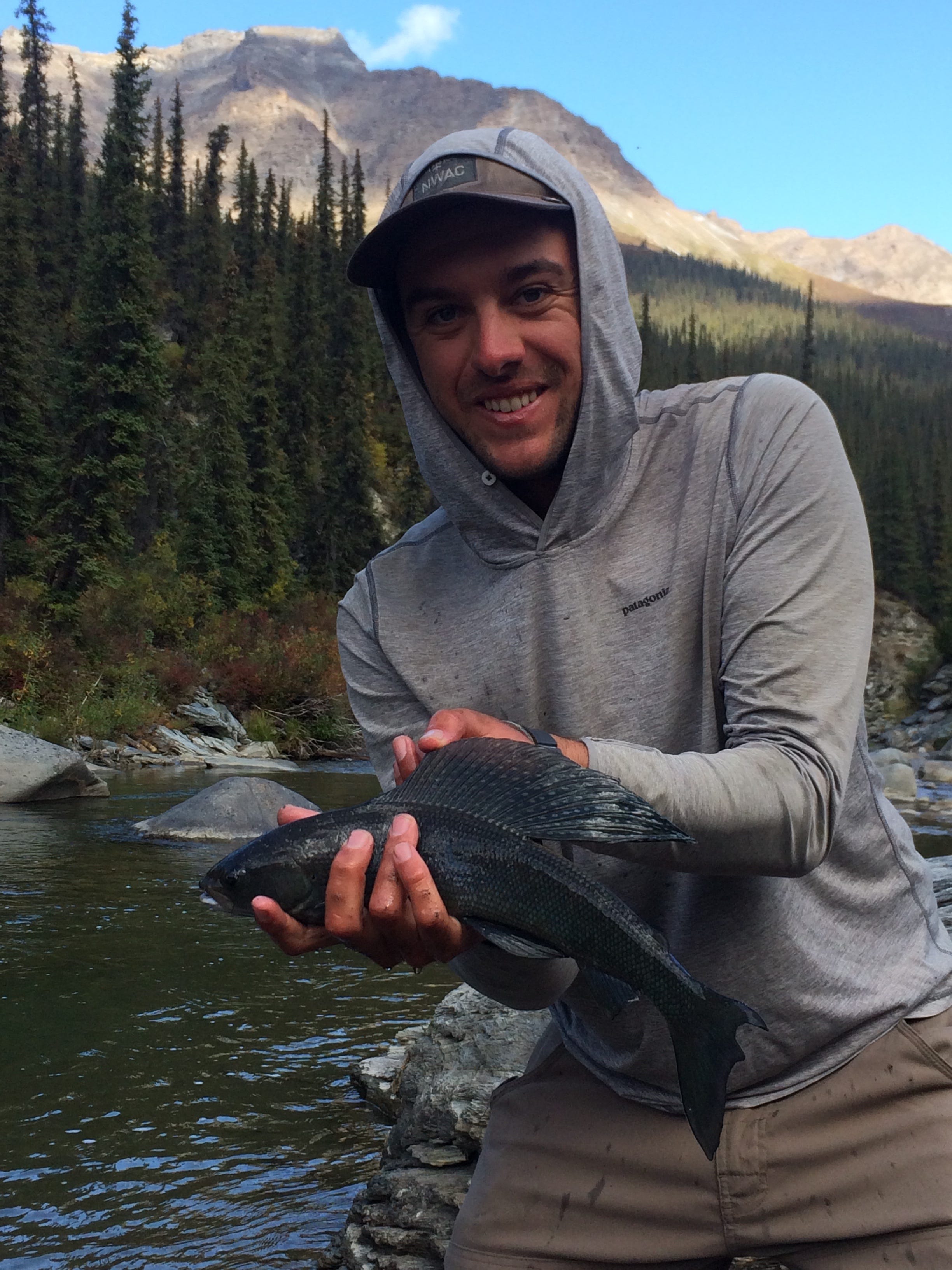
The John River was narrow and meandering. Through the clear water we could see Arctic Grayling swimmingly up to our boats, perhaps curious about what exactly our whale-like packrafts were. From our sandbar camp, we did some tenkara fishing.
The next day we met a guide who was traveling with a group of seven down the John River with plans to fly out at Iniakuk Lake. After passing them, the river changed from deep and narrow to wide and covered with shallow rock gardens where we floated or drug our boats over the rocks. We were concerned about the integrity of the packrafts, knowing that we were relying on them for many more days of down-river travel; however, they proved to be very durable. Eventually, as we passed through deeper layers of shale and tributaries that joined the John, the river grew deeper and we encountered consistent class 2 whitewater with a few class 3 rapids appearing at the sharpest bends of the river. That day, we travelled about 30 miles on the river. We had seen a skinny black bear on the bank that looked excited and unafraid when we floated by, so we decided to give it plenty of space for the night.
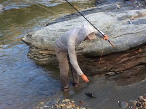 It was August 20th, Noah’s birthday! We paddled on calm water down the John River to its confluence with Wolverine Creek. Following a sheep hunting trail marked with a rare set of footprints, we ascended up the Wolverine Creek drainage. Our goal over the next four days was to walk a 75-mile route west between the John and Atlanta rivers. We took the north fork of Wolverine Creek, making numerous stream crossings, bushwhacking at lower elevations, and casting for fish; Arthur caught two Arctic Graylings. We climbed over two passes just to the south of Nahtuk Mountain. It was a unique middle point of the trip to gain perspective because we could look out and see both where we had been and where we would be going.
After departing from our camp below Nahtuk Mountain, although the bushwhacking was dense, we soon arrived at the Nahtuk River. The wide gravel bars soon disappeared as the drainage narrowed and deepened. With the rising water level we decided to fight our way through the thicket, bushwhacking up and over sections of the drainage to create shortcuts. We would time our hourly breaks to stop in blueberry patches where we could eat to our hearts’ content.
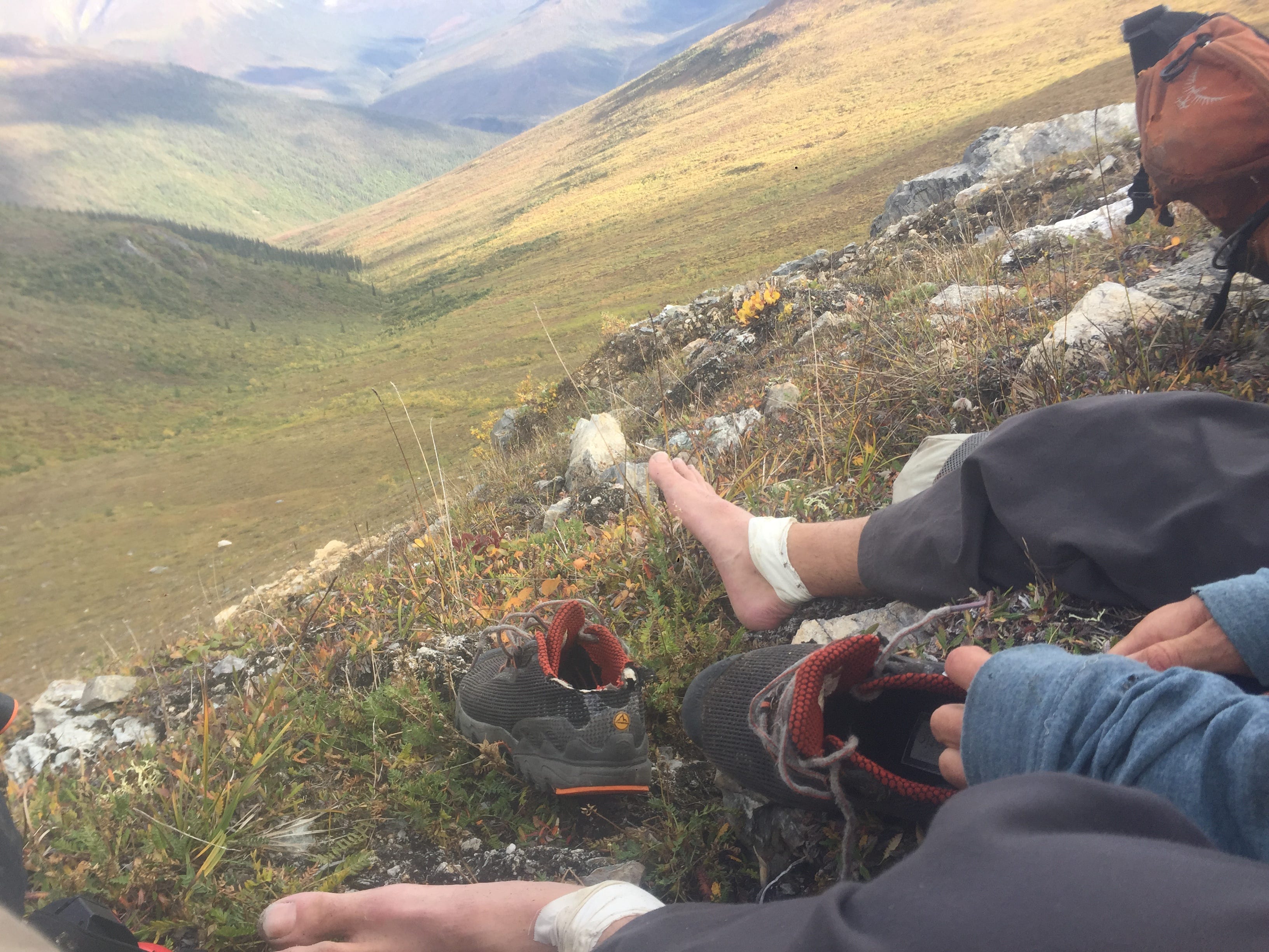
We exited the Nahtuk River and began to head towards the Pingaluk River to give us easier access to the Arrigetch. First, we needed to make it over the pass that separates the two drainages. Our path involved scrambling up some 4th class shale, bushwhacking first through trees, then through bushes and shrubs. We were exhausted by the time we reached the pass; Noah had even intentionally cut part of the heels of his shoes off because his Achilles’ tendons had been bothering him consistently!
From our camp, we could see the striking Arrigetch Peaks. While we had initially planned on hiking and packrafting there, that night we decided not to include the additional area. The unprecedented bushwhacking of the past few days had put us half a day behind schedule, and we had no room to extend the end date of our trip due to a need to return to work at Outward Bound. Ultimately, we were satisfied with our decision to not cram in a section in the Arrigetch. 160 miles of the Alatna River still awaited us, and we had six days to finish it. Plus, after a demanding land section, we were looking forward to focusing on packrafting and fishing.
The following morning we woke up to frost on the tent and had our first coffee on the trip. We descended along the Pingaluk River which, even though it was not floatable, still offered flat gravel bars to walk on for the three miles until it met the Alatna River. At the confluence the two rivers swirled together in two shades of green. A cliff band paralleled the Alatna, and on the other sides stretched an enormous valley contained by tall peaks of shale. It was sunset and the golden light highlighted a thunder storm arriving from the North.
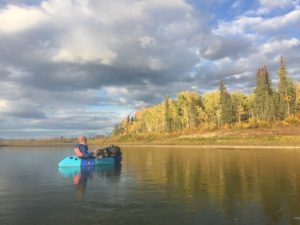
The following five days were spent packrafting and fishing on the Alatna. We paddled between 25 and 37 miles each day, with speeds ranging from 2.5 to 3.5 miles per hour. Before the trip we had expected to paddle about 25 miles per day and walk about 15 miles per day. Despite paddling against strong, ongoing headwinds during two days on a relatively slow-moving river, we were pleasantly surprised to have a better pace than expected. We speculate that the increase may have been due to the fact that we were paddling consistency for about eleven hours each day.
In hindsight, most days we did not meet our goal of walking fifteen miles per day. The range of our daily mileage by foot fell between six and sixteen, despite hiking between ten and twelve hours each day. We likely underestimated the toll that off-trail conditions (bushwhacking, river crossings, tussocks, scree slopes) and carrying three weeks worth of food took on our pace. Additionally, we took some unplanned breaks to fish and take care of our inflamed Achilles’ tendons.
One of our camps along the Alatna gave us access to fish in a tributary that had clearer and faster-moving water than the Alatna itself. We saw dozens of dead, but intact, Chum Salmon scattered around the bottom of the stream. There were also numerous fish heads along the shore. We found a group of salmon still trying to swim upstream through the shallow water. Although we tried every fly we had brought, the fish were uninterested in feeding. We later learned that these salmon were so old that they would not have been good to eat anyways. In fact, they were on the last leg of their journey over thousands of miles from the ocean to lay eggs in the same stream where they were born. Presumably, the dead salmon that we also saw had already accomplished their purpose of laying eggs, or had died trying, and then had been washed downstream.
During one day on the Alatna, we saw a young black bear from the river, with a brown coat (referred to as “cinnamon phase”). This one was more shy than the other but still curious; it retreated from the beach to the bushes where it paced back and forth and stared at us. Just after we passed, it swam across the river. We saw many swans and mergansers, golden and bald eagles, and two beavers, too.
On August 31st we woke up early and paddled the last five miles to Allakaket. We had been open to the idea of paddling past Allakaket an additional 75 or so miles on the Koyukuk River for the opportunity to paddle on another river and take out in the town of Hughes; however, we simply did not have time based on our pace. Thus, we finished the expedition, having paddled about 230 miles and hiked about 175 miles during 19 days. We caught five Arctic Grayling. We later found out that 2020 has been an especially difficult year for catching salmon due to warming water temperatures, increased size-specific fishing, smaller fish size, and competition for resources with hatchery fish, according to the Fairbanks Daily News. This made us feel a little better about our various failed attempts to catch salmon on the Alatna River.
We want to thank Roman Dial for some precious data because, until we joined the Alatna River, our route copied one of his. Neither of us had spent time in Alaska before, and, despite having experience with off-trail hiking in Colorado and Utah, we found it invaluable to build our trip based off of the route of someone much more experienced with the Brooks Range.
Although we carried all of our food only because the pandemic complicated doing a cost-effective food drop in Anaktuvuk Pass or with a local guide at a different location, we decided that it might have been better to start the trip with a river section when our packs were the heaviest.
We liked interspersing packrafting sections between walking sections to let our legs recover. Additionally, doing a combined packrafting and hiking trip in the Brooks Range worked well because many of the villages are located on the rivers and the range offered many options to add or subtract sections. For example, we could have simply continued floating on the John River to Bettles instead of hiking to the Alatna. Also, with more time, we could have added a hiking section in the Arrigetch before packrafting on the Alatna.
Overall, we were very happy with our choice of route. It was physically demanding and offered a remote wilderness experience on a scale that neither of us had come close to before.